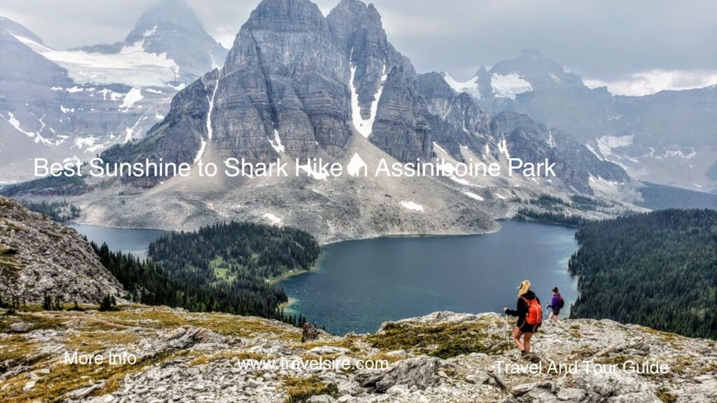
- Introduction
- Top 10 Highlights on the Mount Assiniboine via Sunshine Meadows to Mount Shark Route
- 1. Sunshine Meadows to Citadel Pass: An Alpine Paradise Start
- 2. Citadel Pass to Porcupine Camp: A Quiet Interlude
- 3. Valley of the Rocks: Surreal Scenery
- 4. Og Lake Campground: First Glimpse of Assiniboine
- 5. Assiniboine Lodge Area: Heart of the Park
- 6. Lake Magog to Nub Peak: Epic Day Hike
- 7. Wonder Pass: Glacier-Capped Views
- 8. Bryant Creek Shelter: Rustic Refuge
- 9. Mount Shark Trailhead Approach: Final Stretch
- 10. Optional Helicopter Access: Skip the Climb
- Hiker’s Guide: Planning Your Trip to Mount Assiniboine via Sunshine Meadows to Mount Shark
- Conclusion
Introduction
Hike in Assiniboine Park via Sunshine Meadows to Mount Shark attracts over 5 million outdoor enthusiasts annually, thanks to its breathtaking alpine scenery, world-class hiking routes, and incredible backcountry experiences. Nestled in the heart of the Canadian Rockies, this multi-day hike is often dubbed the “Matterhorn of the Rockies” and offers a bucket-list experience for backpackers across the globe.
Read More About Hiking
Whether you’re craving wildflower meadows, glacial lakes, or the chance to disconnect in Mount Assiniboine Provincial Park, this guide covers everything you need. From trail details and permit info to campsite options and logistical tips, here’s your ultimate guide to exploring Mount Assiniboine via Sunshine Meadows to Mount Shark.
Top 10 Highlights on the Mount Assiniboine via Sunshine Meadows to Mount Shark Route
The full Sunshine Village to Mount Shark route spans approximately 55 km (34 miles) and takes 3–5 days to complete, depending on your pace and chosen detours. Below are the top 10 segments or highlights to explore along the trail:
1. Sunshine Meadows to Citadel Pass: An Alpine Paradise Start
- Trail Overview: 8.6 km | 3–4 hours | Moderate
- Key Highlights: Lush meadows, alpine wildflowers, and panoramic views of Quartz Hill
- Accessibility: Start at Sunshine Village (consider gondola or shuttle for a head start)
- Pros: Easy gradient, scenic beginning
- Cons: Exposed to weather; popular with day hikers
Mount Assiniboine via Sunshine Meadows to Mount Shark begins in one of Banff’s most photogenic areas—Sunshine Meadows. This stretch offers a gentle introduction, rich in wildflowers and bird sightings, making it ideal for acclimatization.
2. Citadel Pass to Porcupine Camp: A Quiet Interlude
- Trail Overview: 6.3 km | 2–3 hours | Moderate
- Key Highlights: Peaceful ridgelines and wildlife viewing
- Accessibility: Primitive camping at Porcupine
- Pros: Less crowded, good spot for overnight
- Cons: Basic campsite amenities
A short yet rewarding segment, this stretch leads you into the backcountry with quieter trails and views into the Simpson River Valley. It’s a key stop for many backpackers on the Mount Assiniboine backpacking route.
3. Valley of the Rocks: Surreal Scenery
- Trail Overview: 9.4 km | 4 hours | Moderate
- Key Highlights: Strange rock formations and expansive views
- Accessibility: Good signage; GPS recommended
- Pros: Unique geology
- Cons: Exposed and dry, bring extra water
A fan-favorite portion of the Sunshine Meadows to Mount Shark hike, this surreal valley feels like another planet with boulder-strewn landscapes.
4. Og Lake Campground: First Glimpse of Assiniboine
- Trail Overview: 4.5 km from Valley of the Rocks | 1.5 hours | Easy
- Key Highlights: Views of Mount Assiniboine from across Og Lake
- Accessibility: Reservation campsite
- Pros: Ideal overnight stop
- Cons: Can be windy and buggy
Backcountry camping here is unforgettable. Wake up to sunrise over the peak and enjoy close proximity to the next major stop.
5. Assiniboine Lodge Area: Heart of the Park
- Trail Overview: 5 km | 1.5 hours | Easy
- Key Highlights: Lake Magog, Assiniboine Lodge, and core trail networks
- Accessibility: Helicopter drop-off available
- Pros: Spectacular scenery, optional day hikes
- Cons: Can get crowded in peak season
This central area in Mount Assiniboine Provincial Park is perfect for basecamping. The Assiniboine Lodge hiking trip is a luxurious alternative to backpacking.
6. Lake Magog to Nub Peak: Epic Day Hike
- Trail Overview: 7.5 km round trip | 3–4 hours | Moderate to Hard
- Key Highlights: Best view of Mount Assiniboine
- Accessibility: Day hike from Magog or Naiset Huts
- Pros: Iconic panorama
- Cons: Steep ascent
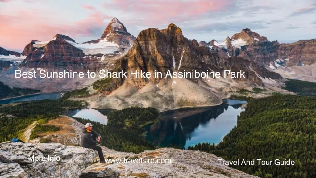
Nub Peak delivers jaw-dropping views of Sunburst Lake, Cerulean Lake, and the iconic Mount Assiniboine. A must-do detour on your Mount Assiniboine itinerary.
7. Wonder Pass: Glacier-Capped Views
- Trail Overview: 6.5 km | 2–3 hours | Moderate
- Key Highlights: Dramatic mountain views and pristine meadows
- Accessibility: Clear signage, creek crossings
- Pros: Scenic ridge walk
- Cons: Steep in sections, snow persists into July
Crossing Wonder Pass connects the Mount Assiniboine core to the Bryant Creek Valley. This area truly showcases the grandeur of the Canadian Rockies hiking trails.
8. Bryant Creek Shelter: Rustic Refuge
- Trail Overview: 10 km | 3–4 hours | Easy to Moderate
- Key Highlights: River views, dense forest
- Accessibility: Well-marked trail
- Pros: Shelter with a wood stove
- Cons: Mosquitos in summer
Ideal for a final night stop, the Mount Assiniboine backcountry camping at Bryant Creek is basic but sheltered.
9. Mount Shark Trailhead Approach: Final Stretch
- Trail Overview: 13 km | 3–5 hours | Moderate
- Key Highlights: Gentle descent, return to civilization
- Accessibility: Shuttle service available
- Pros: Wide trails, gradual finish
- Cons: Long stretch after multiple days of hiking
The Mount Shark trailhead wraps up your journey. Make sure you’ve arranged a car shuttle or use the Assiniboine shuttle services from Canmore or Banff.
10. Optional Helicopter Access: Skip the Climb
- Trail Overview: N/A (via helicopter from Canmore or Mount Shark)
- Key Highlights: Aerial views of Assiniboine
- Accessibility: Reservation required
- Pros: Saves time and energy
- Cons: Expensive; weather-dependent
If you’re short on time or energy, consider Mount Assiniboine helicopter access to reach Lake Magog directly. Great for photographers or lodge guests.
- Upgrades from our Previous Generation UV-5R: Twice the Output Power (8 watts up from 4 watts output), New Hardened Durab…
- High / Med / Low Power Settings (8W, 4W, 1W); Frequency Range: VHF: 136-174 MHz(Rx/Tx). UHF: 400-520 MHz(Rx/Tx); Broad (…
- The BF-F8HP was designed in the USA and because not everyone is a radio-expert we really wanted to focus on providing an…

Hiker’s Guide: Planning Your Trip to Mount Assiniboine via Sunshine Meadows to Mount Shark
Recap of Top Hikes
The Mount Assiniboine via Sunshine Meadows to Mount Shark route features a perfect blend of scenic meadows, rugged alpine passes, and serene lakes. Highlights include Citadel Pass, Nub Peak, and the dramatic Wonder Pass.
Best Time to Hike Mount Assiniboine
- June to mid-July: Snow lingers on passes
- Late July to September: Ideal conditions
- October–May: Not recommended due to snow and avalanche risk
Peak wildflower blooms happen from mid-July to early August, making this the best time to hike Mount Assiniboine.
Gear Essentials
- Lightweight tent and sleeping bag
- Bear canister or Ursack (required for backcountry camping)
- Water purification system
- Layers for changing weather
- Detailed maps or GPS
- Trekking poles for descents
- Sunscreen, hat, and bug spray
Permits & Reservations
- Backcountry Camping: Requires reservation through Parks Canada or BC Parks, depending on location
- Sunshine Shuttle or Gondola: Book in advance
- Helicopter Flights: Available from Canmore or Mount Shark—must be reserved early
- Assiniboine Lodge/Naiset Huts: Also requires pre-booking
Apply for your Mount Assiniboine permit well in advance during the summer months.
Safety Tips
- Check trail conditions and wildfire warnings
- Carry bear spray and know how to use it
- Stay on marked trails to protect the environment
- Practice Leave No Trace principles
- Hike in groups when possible
- Prepare for sudden weather changes
Conclusion
Whether you’re an experienced backpacker or looking to elevate your hiking game, Mount Assiniboine via Sunshine Meadows to Mount Shark is a trek that truly has it all—wild alpine meadows, glacial lakes, rugged peaks, and serene wilderness.
Start planning your next adventure on this iconic Canadian Rockies route. Don’t forget to share your journey, tips, or favorite trail moments in the comments or on social media. Let’s keep the spirit of exploration alive—see you on the trail!
Best Backpacking Loops Yoho Has to Offer
How to Backpack to Havasupai and Havasu Falls
The Complete Guide to Backpacking Tonquin Valley | Jasper’s Hidden Gem
How to Hike Canyon Creek Lakes in California


